Sedona
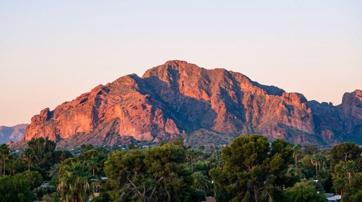
Sedona is a city that straddles the county line between Coconino and Yavapai counties in the northern Verde Valley region of Arizona, surrounded by the Coconino National Forest. The city sits at roughly 4,350 to 4,500 feet elevation and is known for its red sandstone rock formations.
Kelly serves buyers and sellers in Sedona.
Schools
Sedona is served by the Sedona-Oak Creek Unified School District, which includes Sedona Red Rock Junior Senior High School and West Sedona School. The district includes portions of both Yavapai and Coconino counties and also serves the Village of Oak Creek and Red Rock. Residents can check county GIS mapping services through the City of Sedona for boundary information, since Sedona spans two counties.
Getting around
From Phoenix, Sedona is reached by taking Interstate 17 north to the Sedona-Oak Creek Canyon exit, then State Route 179 west, a drive of about 90 minutes. From Flagstaff, Sedona is reachable via I-17 or via State Route 89A through Oak Creek Canyon. Sedona Airport (FAA: SEZ) is a small general aviation facility, and the nearest major commercial airport is in Phoenix.
Homes and housing
Sedona's housing areas include West Sedona, Uptown Sedona, the Chapel area near Little Horse Park, Red Rock Loop, and Big Park/Village of Oak Creek. Many homes in Big Park and Sedona City Center were built between the 1970s and 1990s, with some older residences in City Center dating to between 1940 and 1969. Red Rock Loop includes a mix of three- to four-bedroom single-family homes, smaller two-bedroom houses, and mobile homes. The city has also approved newer multi-unit developments, including workforce and affordable housing projects such as Villas on Shelby, Navajo Lofts, and Goodrow Housing.
Things to do
The City of Sedona's park system covers 126 acres across nine parks, including Posse Grounds Park (with a dog park, bike skills park, skate park, and disc golf), Piñon Park, Sunset Park, and Sedona Wetlands Preserve. Nearby state parks include Red Rock State Park and Slide Rock State Park, about 8 miles north. The area is also known for its arts community, with destinations such as Tlaquepaque Arts & Shopping Village and the galleries along State Route 179.

- Sedona had a population of 9,684 at the 2020 census. Sedona, Arizona
- Sedona was incorporated in 1988. Sedona, Arizona
- Sedona's ZIP code is 86336. Sedona, Arizona
- The City of Sedona park system totals 126 acres across nine parks. Parks & Recreation
- Sedona-Oak Creek Unified School District operates Sedona Red Rock Junior Senior High School, established in 1994. Sedona Red Rock Junior Senior High School
- Slide Rock State Park is located 8 miles north of Sedona. Sedona, Arizona - DesertUSA